AHRS Utility 2.0
Device: iOS Universal
Category: Navigation
Price: Free, Version: 1.0 -> 2.0 (iTunes)
 Description:
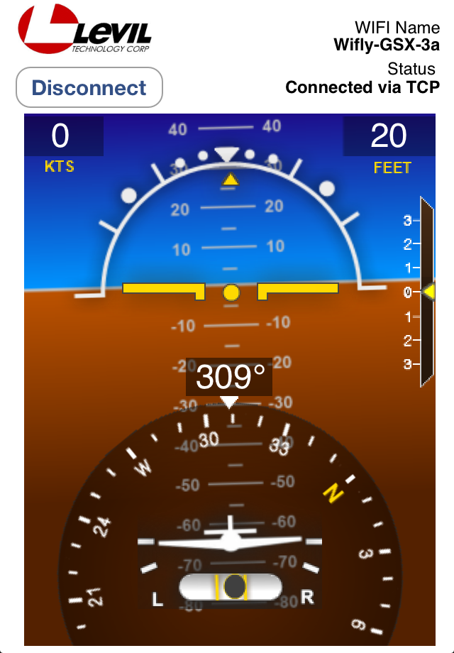
AHRS utility is a free application designed to display Levil's AHRS data graphically and numerically. This application is only compatible with the Attitude and Heading Reference System from Levil Technology, model AHRS G mini. AHRS Utility allows users to troubleshoot their AHRS. For example, pilots have access to a table of possible errors, battery level, WiFi configuration etc. Users must be connected to the wireless network of the AHRS -G mini. The application will NOT display airplane attitude based on the internal gyros of your iPad/iPhone or GPS data.CONFIGURATION MANAGER:This application is also designed to configure the WiFi transmitter to send UDP broadcasts (in addition to the standard TCP). UDP allows multiple devices to connect simultaneously to the AHRS. Please note that UDP broadcasting will be paused if connected via TCP on any other device. As soon as the TCP connection is released, UDP broadcasting will resume. NOTE: Although your instrument may be UDP enabled, some applications are not yet compatible with this type of protocol. You should check with your Navigation app to see if they are UDP compatible. (AHRS Utility and the latest version of Digital Sectional are the first applications to offer UDP connectivity with the AHRS G mini)At start-up the application will attempt to connect automatically via TCP. For UDP connection, click Disconnect, select the UDP tab and click Connect. To enable UDP connection for the first time, click Disconnect, click Enable UDP Broadcast under Configuration manager, wait until the configuration is done, select the UDP tab and then click Connect.AIR DATA:Air data is only available on the AW model. Pressure altitude is displayed on both locations:1. Top left corner of the Horizon view. This value is adjusted according to the altimeter setting to the left.2. Under "Air Data". This value is NOT adjusted by the altimeter setting. Airspeed indicator is displayed in KTS. This value will remain equal to zero for speeds lower than 30 KTS. Speed is accurate up to 200 KTS.POWER:Battery % is calculated based on the current voltage measured. However, this value is ONLY reliable when no external voltage has been applied. If the battery switch is OFF but external voltage is being applied, then the battery % output is no longer valid since the output was based on external voltage rather than battery voltage. Also, if the battery switch is ON and external voltage is being applied, battery % output will be higher and thus incorrect. This application is not meant to be used as a Primary Flight Display or for IFR flight.
What's New
Support for iLevil Devices:- GDL90 protocol is now supported- SkyRadar-Gmini combination is now supported- GPS from iLevil devices now supportedEngine layout:- Engine gauges integrated into display for future integration- Analog gauges are now available to display Pressure Altitude (from AW devices) or GPS derived air data
AHRS Utility